US concentrates its naval and air forces around Iran, near Strait of Hormuz. The Maritime Security Belt 2026 exercise takes place at the same time as ongoing US tanker and ISR operations. This shows how operational preparedness, chokepoint geography, and asymmetric maritime risk affect escalation management.
The Maritime Security Belt 2026 naval exercise is going on right now with Iran, China, and Russia. At the same time, the US is still and clearly using aerial refuelling and airborne early warning planes in European and Middle Eastern corridors. The trilateral exercise happens every year, but its strategic importance changes based on the larger operational environment. For example, the United States has clearly strengthened its air operation sustainment infrastructure by keeping tankers and ISR in the area.
Open-source aircraft tracking data derived from aircraft transponder signals and multilateration coverage indicates continued movement of US KC-135 Stratotanker and KC-46 Pegasus aircraft through key staging and transit nodes, including RAF Mildenhall, Ramstein Air Base and forward operating corridors supporting CENTCOM operations. Although such observations do not represent officially declared deployment figures, the sustained pattern of tanker transit reflects the maintenance of a refuelling pipeline capable of supporting extended air operations. Aerial refuelling aircraft enable prolonged sortie generation, extend operational reach and allow combat aircraft to sustain presence over operational theatres without relying exclusively on fixed forward basing.
Simultaneously, airborne early warning and control aircraft activity, including the E-3G Sentry, has been observed across European staging bases. These platforms provide airspace coordination, early threat detection and operational command support, forming a critical layer within sustained air operation architecture. The combined presence of tanker and airborne early warning aircraft indicates maintenance of a persistent operational support framework consistent with elevated readiness rather than symbolic deployment.
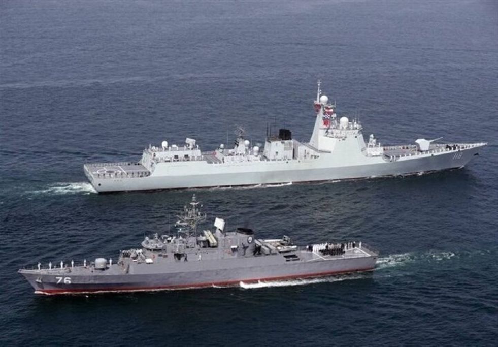
The Maritime Security Belt 2026 has a specific strategic purpose for Iran and its allies within the context of this operational setting. By deploying surface warships and naval forces from both its regular navy and the Islamic Revolutionary Guard Corps Navy in areas connected to the Strait of Hormuz and the northern Indian Ocean, Iran continues to be the dominant player in the operational phase of the conflict. The level of engagement from Russia and China looks to be very low, comprising of rotational deployments and individual surface units that serve to bolster the visibility of the alliance but do not significantly affect the underlying military strength.
Iran’s strategic advantage lies primarily in geography. The Strait of Hormuz represents one of the world’s most critical maritime chokepoints, through which a significant portion of global energy flows. Its narrow confines inherently compress naval manoeuvre space and expose transiting vessels to surveillance, missile coverage and asymmetric maritime activity. Unlike blue-water naval confrontation, operations in and around Hormuz are shaped by proximity, terrain constraint and layered coastal defence capabilities.
Geography is Iran's main strategic advantage. The Strait of Hormuz represents one of the world’s most critical maritime chokepoints, through which a significant portion of global energy flows. Because it is so narrow, it limits the area available for naval manoeuvres and makes it easier for ships passing through to be watched, hit by missiles, and engaged in asymmetric maritime action. Operations in and around Hormuz are different from blue-water naval battles because they are affected by how close they are, the topography, and the different levels of coastal protection.
Iran's naval doctrine stresses asymmetric warfare that takes use of this topography. Quick
The regional missile envelope that Iran has, which encompasses the Strait of Hormuz and the marine routes that are next to it, is also very critical. Iran is able to maintain continual threat coverage over important maritime channels and naval transit routes because to land-based anti-ship missile systems and integrated coastal defence networks it has in place. This multi-layered threat environment poses a persistent risk to both commercial and military marine transportation, which further emphasises the strategic significance of the region.
Within this framework, Maritime Security Belt 2026 functions as a strategic counter-signal to visible US operational readiness. The exercise does not aim to prevent potential US military action through direct force denial. Instead, it reinforces Iran’s deterrence posture by demonstrating coalition presence, operational activity and the existence of a contested maritime environment shaped by geography and asymmetric capability.
The interaction between sustained US tanker and ISR activity and visible multinational naval exercises reflects a reciprocal signalling dynamic. The United States keeps its military ready to go by always having air support available, which lets it project power over time. Iran, with the symbolic assistance of Russian and Chinese naval troops, strengthens the idea that the operational environment is very complicated, with chokepoint geography, asymmetric naval doctrine, and constant missile threat coverage.
Maritime Security Belt 2026 is not a regular military counterbalance; instead, it is a strategic tool that works within the logic of escalation control. It shows that geography, asymmetric capability, and coalition signalling are still important in shaping the operational environment of the Strait of Hormuz and the surrounding area. These are two of the most important aspects of the current security landscape.